Pictures had to wait until I got a better connection, but they’re here now. A great mystery of this walk has been the excellent mobile connection I get for most of the day when out in the wilds, followed by disastrously bad signal when I’m comfortably in my B&B.
I spent half an hour after breakfast on careful foot maintenance. It paid off handsomely, with much less discomfort than yesterday despite rougher walking conditions. More of the same tomorrow.
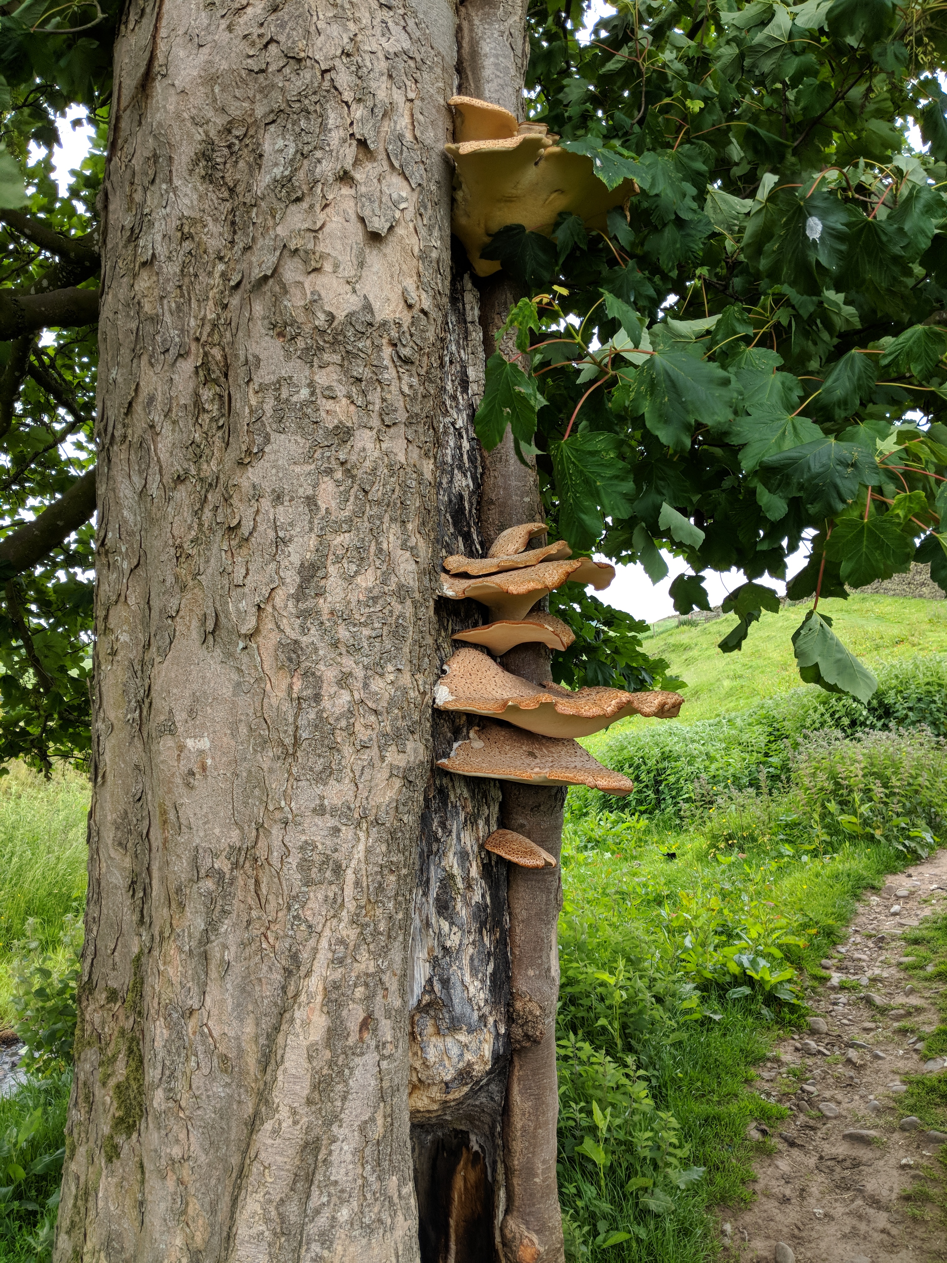
The first highlight of the day was a very impressive bracket fungus colony on a tree just outside Gilsland.
On to Thirlwall Castle, a decaying 15th century keep that helped to discourage the Border Reivers – and, of course, consumed the stone from a mile or two of Hadrian’s Wall.

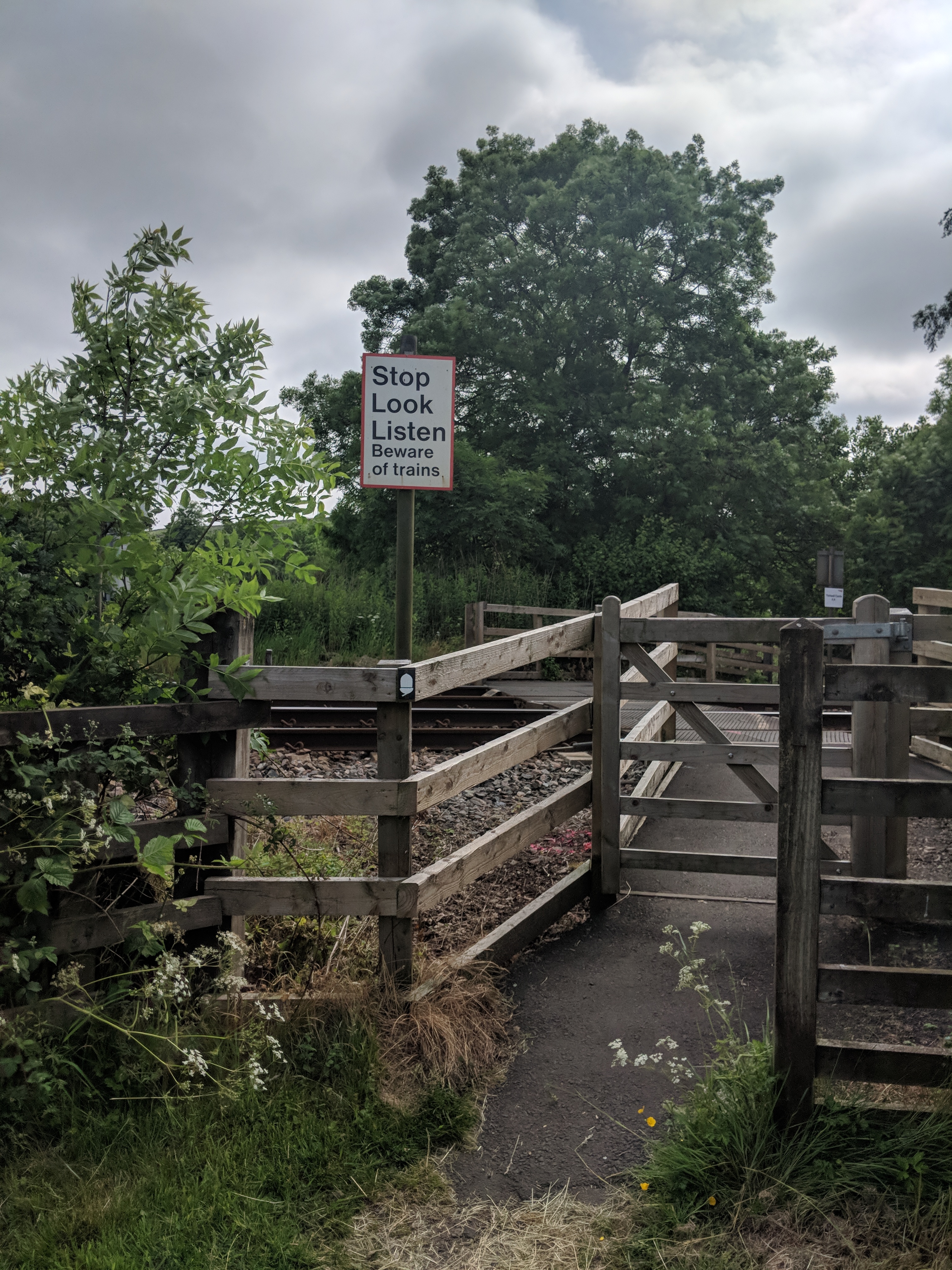
Just before the castle the path makes a completely unprotected crossing of the Newcastle to Carlisle railway – a hazard that the legionaries presumably didn’t need to worry about.
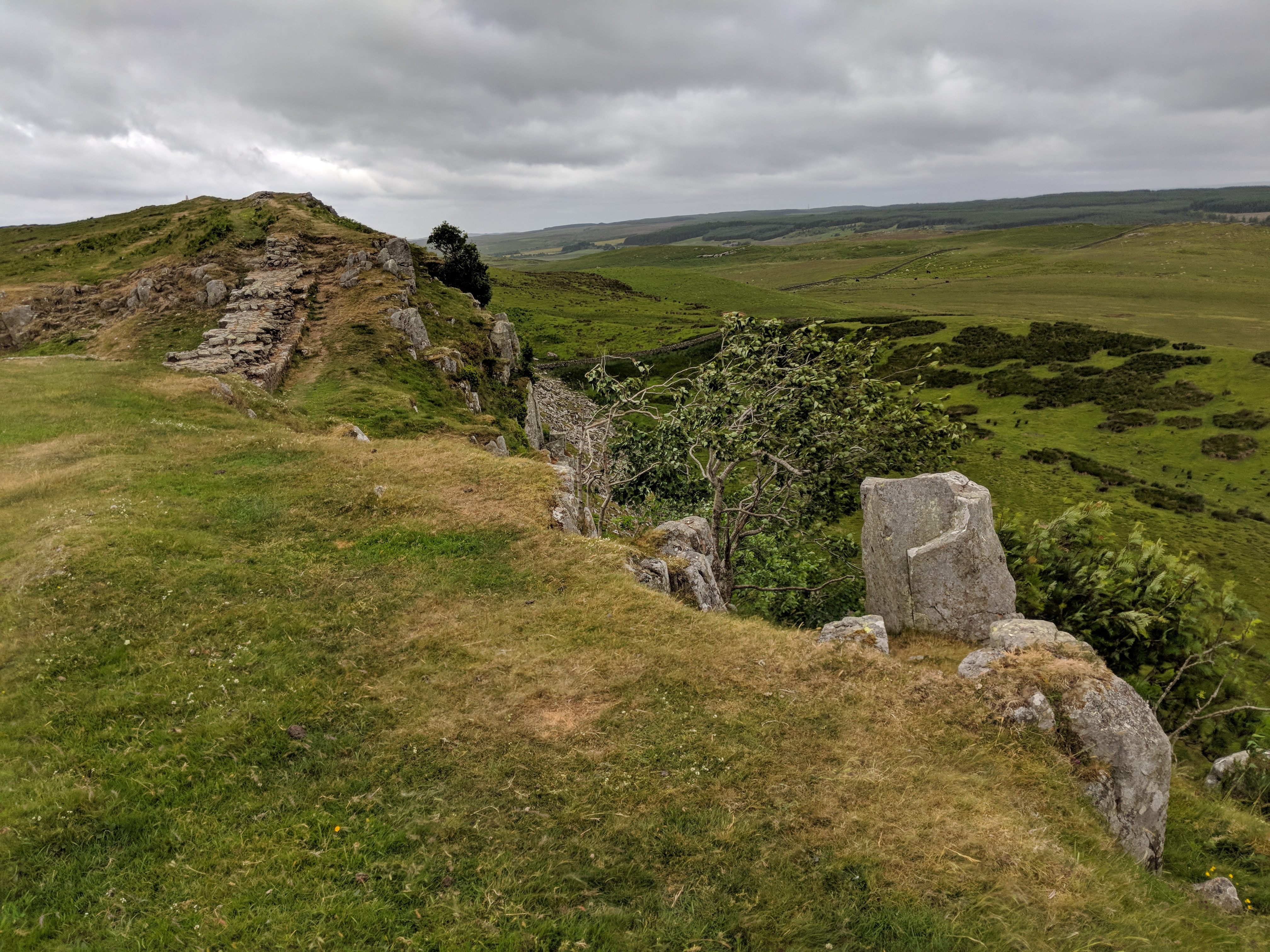
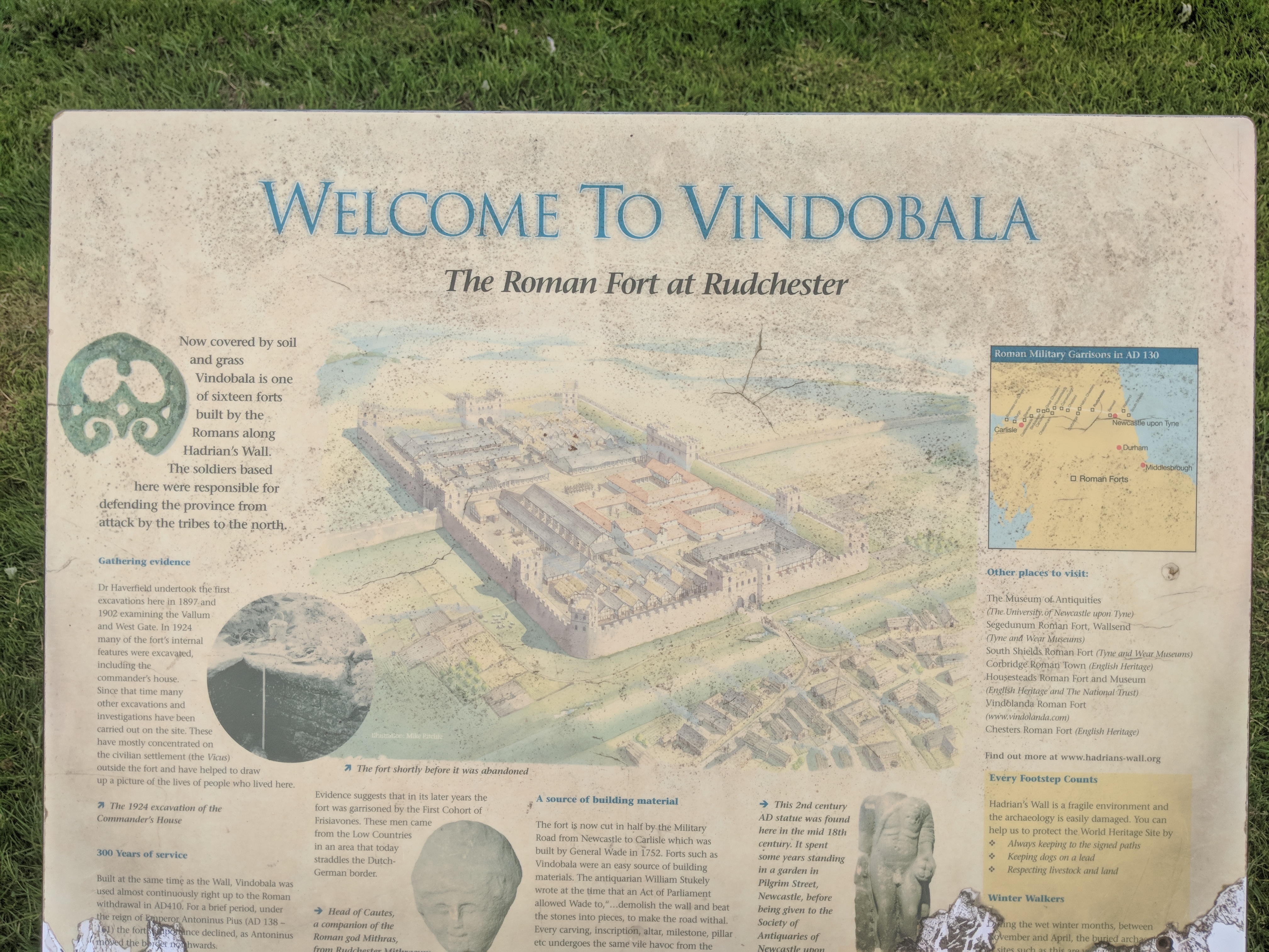
There were also some fine views of the overall shape of the Wall earthworks, which are surprisingly extensive on the southern (Roman) side of the Wall line.

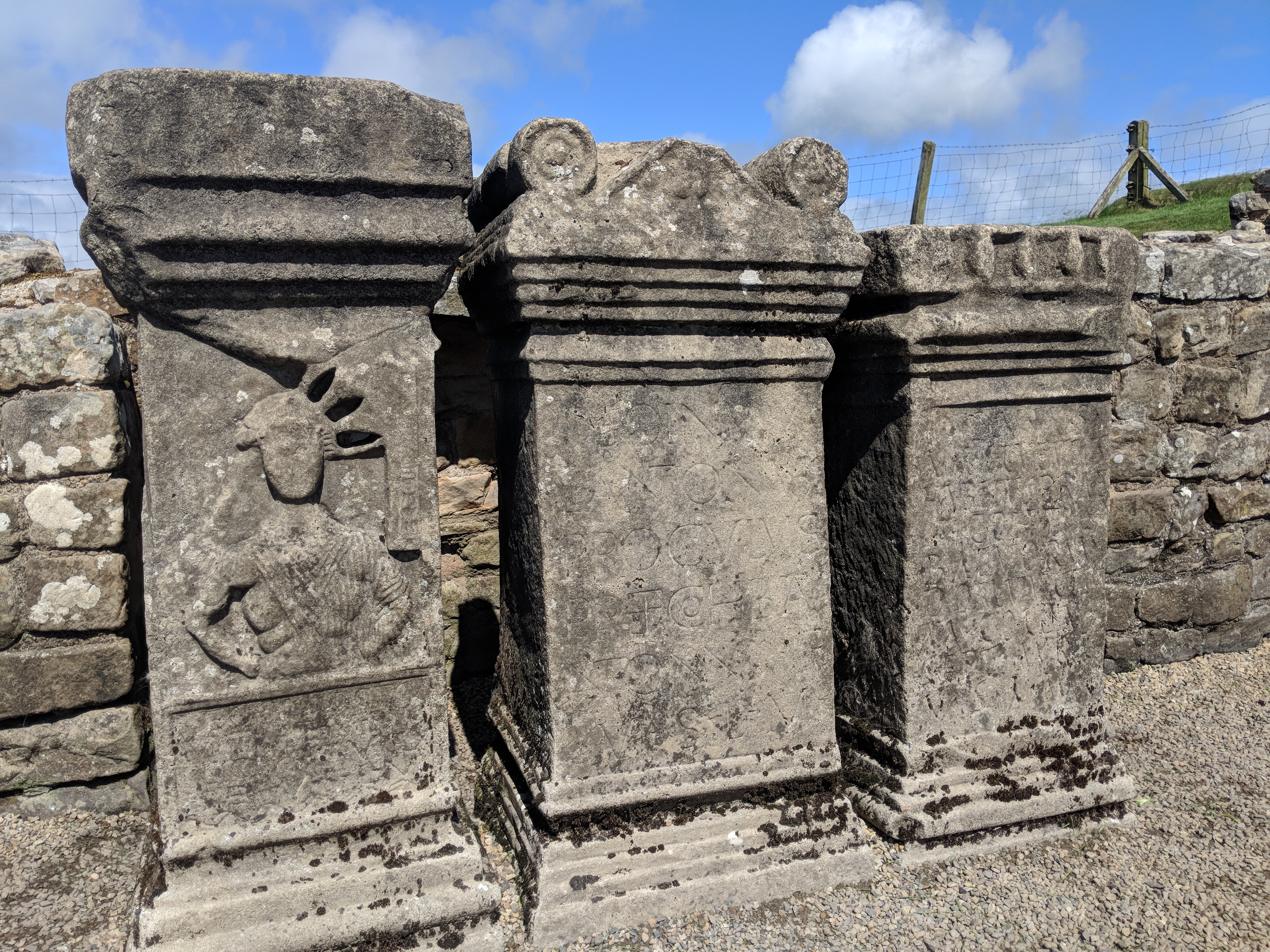
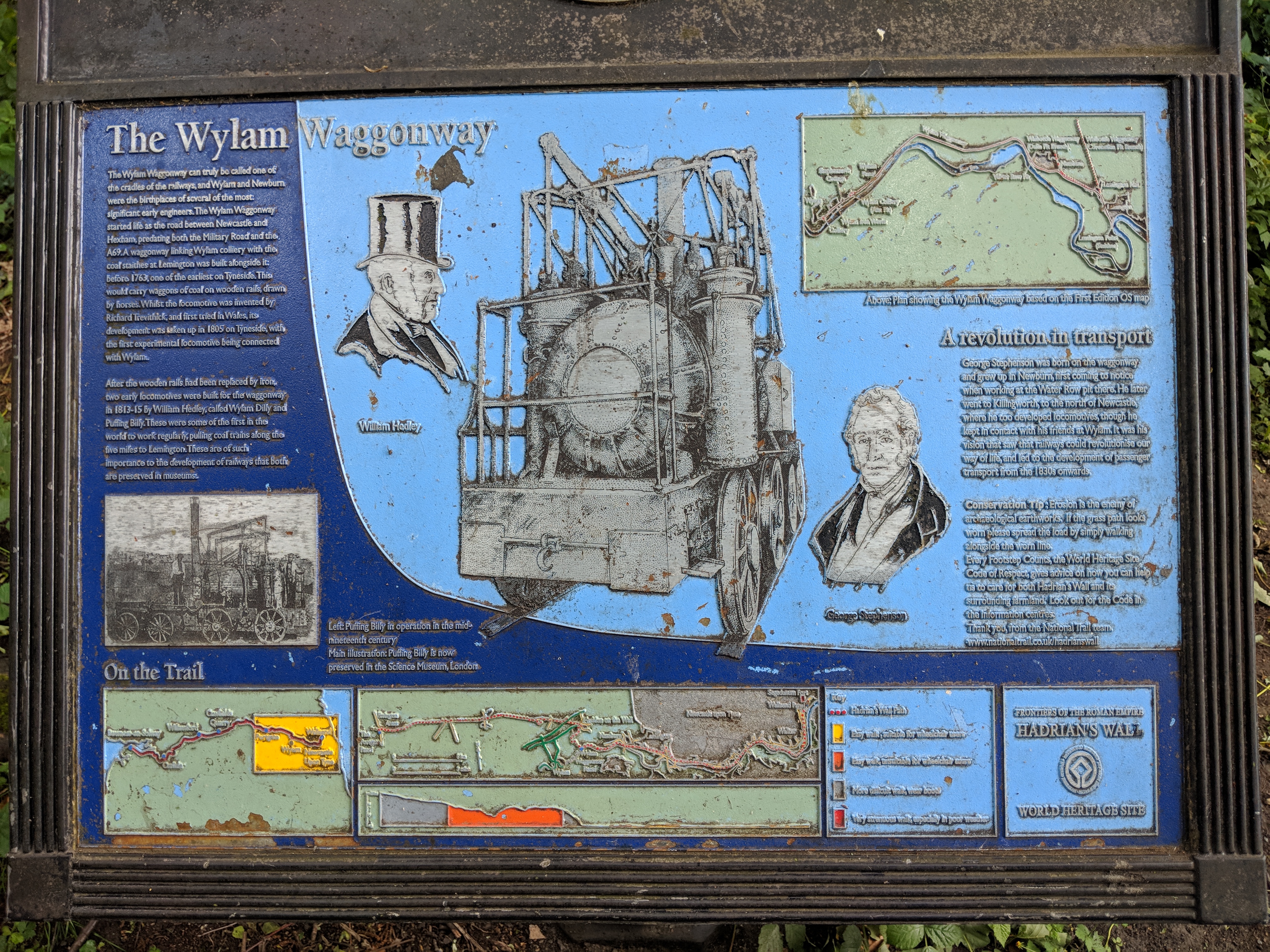
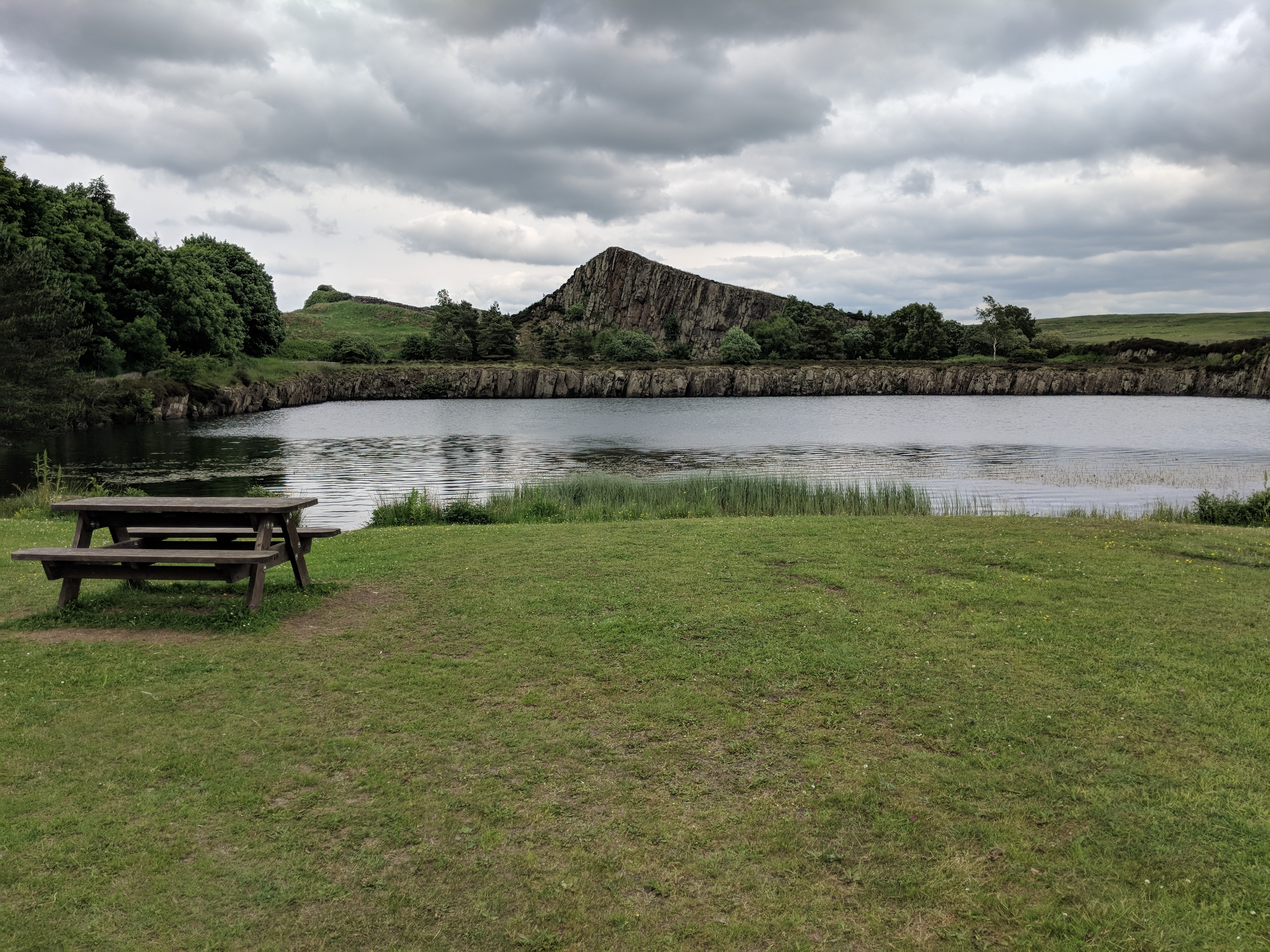
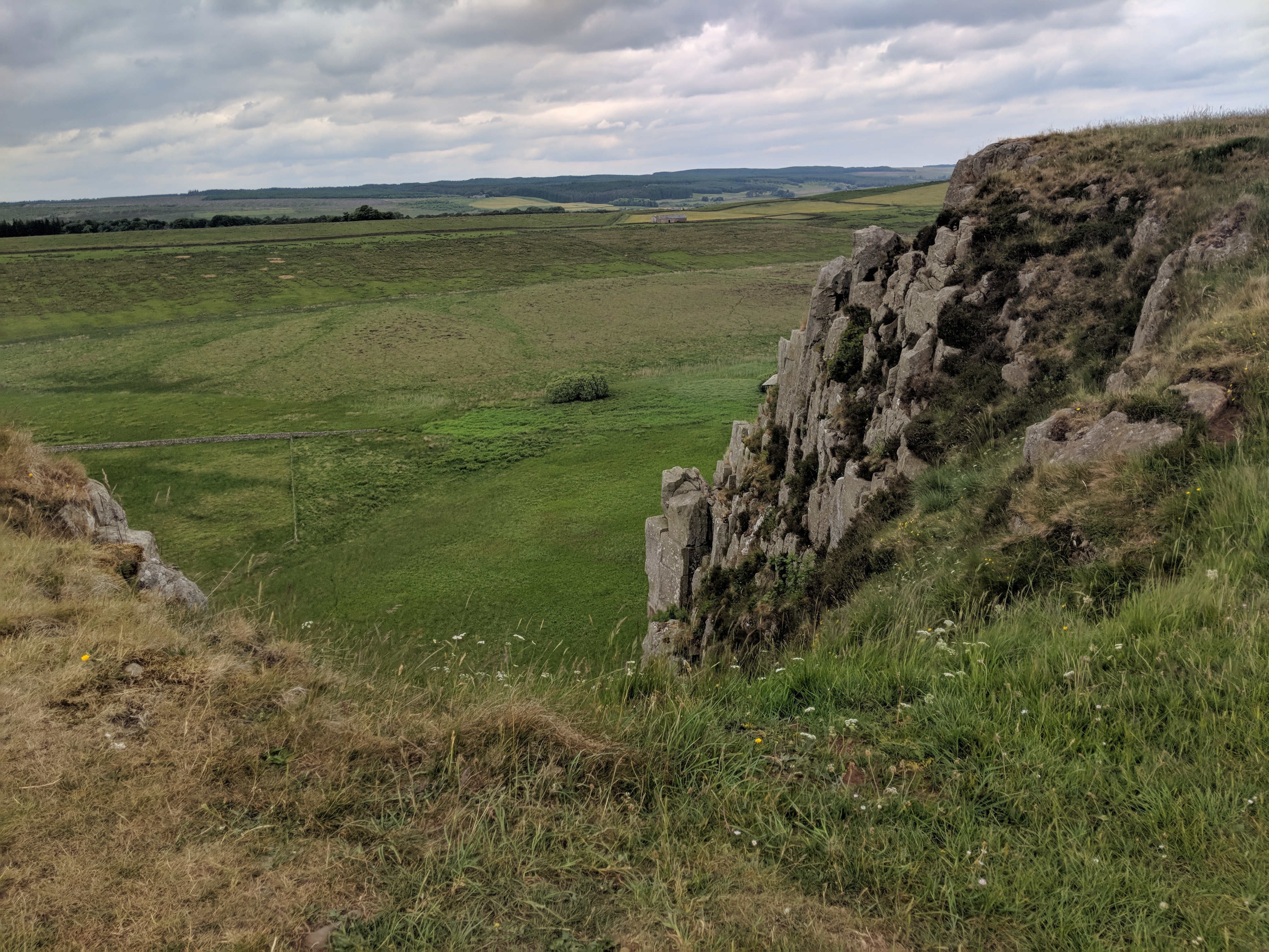
I popped into the Roman Army Museum at Walltown, but they wouldn’t sell me a coffee unless I paid up for a 3D immersive video experience. Since I was busy with an immersive experience of my own, I continued coffee-less, marvelling in passing at Walltown Crags quarry which, right up to the 1940s, brutally and unforgivably chomped its way through both crag and archaeology to mine the hard gritty dolerite for roadstone. This wasn’t the first time on the walk I’d seen the famous Whin Sill, but from this point all the way to Housesteads it’s the magnificent dominant feature of the landscape. It’s hardly surprising Hadrian’s engineers chose its crest to carry the Wall, as the north-facing cliff must have saved them no end of ditch-digging.
Ancient eroded escarpments come at a price for walkers, though. The Wall and path go through a seemingly endless series of fierce little switchbacks, gaining a couple of hundred feet in height over as many yards, only to lose that height again a few paces further on. To avoid erosion the path now has steps on most of these “nicks”, but they still cost plenty of puff in the way mountaineering author W.A.Poucher so memorably described as “collar work”. Numerous photos were taken, making a fine excuse for equally numerous short breaks – I averaged only about 1.6mph today.

My combination of slowness, sore feet and poor aerobic fitness led me to abandon plans for a side trip to Vindolanda museum. It’ll just have to wait for another visit. Similarly, I was debating whether to divert half a mile to the new visitor centre “The Sill” at Once Brewed, when a friendly couple told me that I could instead get my much-desired cuppa from a food van parked in a viewpoint car park right beside the trail. By the time I arrived the promised mobile tea shop had packed up and gone home, and I was so despondent I just carried on.
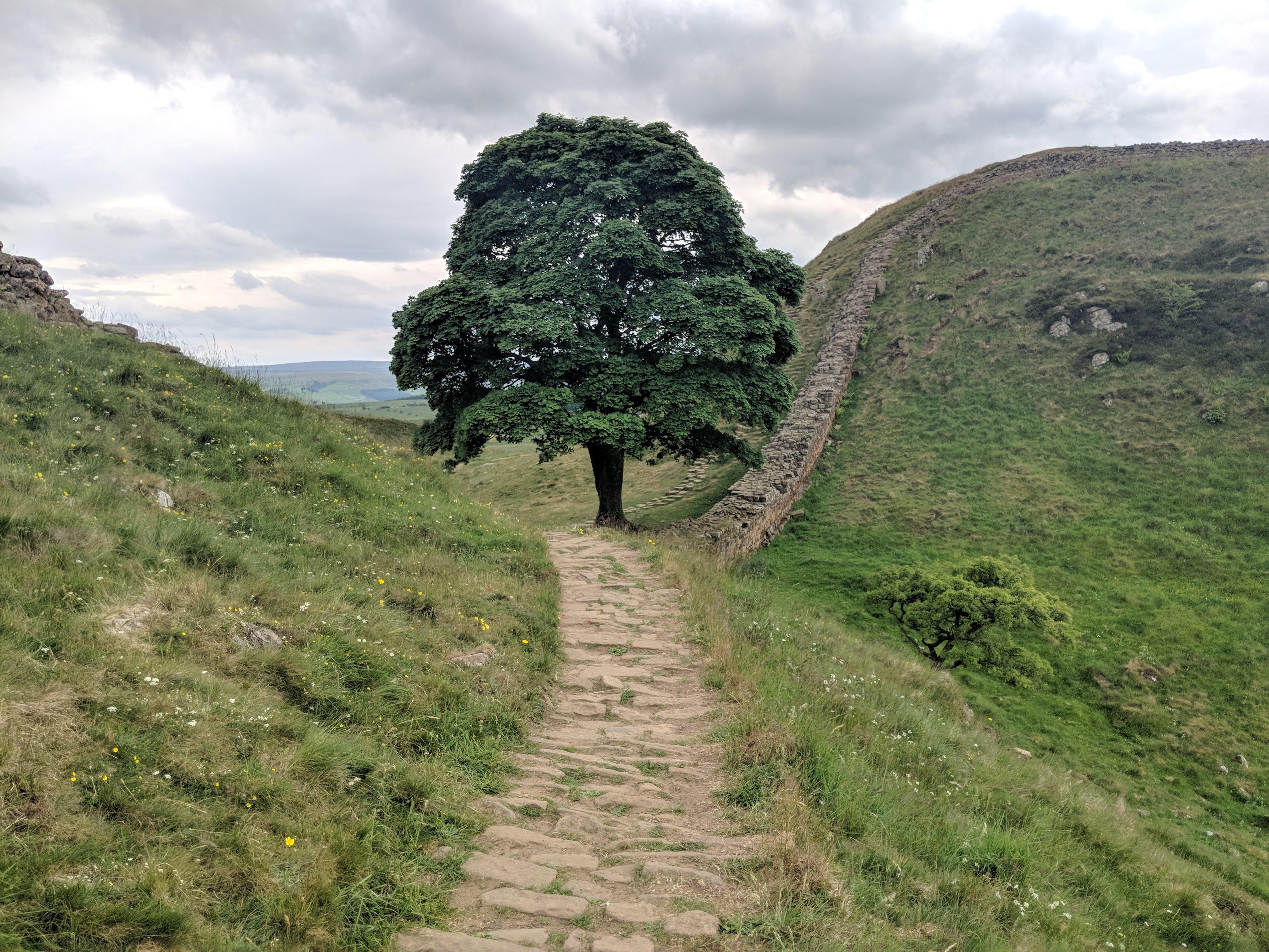
By now I was very close to the famously photogenic Sycamore Gap. On the way up one of the nicks just before it… my phone crashed. I have no idea why. Perhaps it just knew its services were about to be in demand. Anyway, that made me realize how much I’d come to depend on it: clock, camera, location reporting device, speedometer, compass, OS map display (I’ll have more to say about the OS map app in another post). I have the SLR camera with me too, and it takes better photos, but I have no way to copy them into the blog. Anyway, out came the SLR from my pack. At last, though, just at the top of the steps down to Sycamore Gap, I figured out how to restart the phone by doing a wardance on its volume and on-off buttons. Normally of course I’d just ask Google how to do it, but… you get the idea.
The stretch from Sycamore Gap to Housesteads is just a delight. Up-and-down a-plenty, including some sneaky little unexpected ones that aren’t too obvious from the contour map, but wonderfully varied views including the dramatic rock formations above Crag Lough.
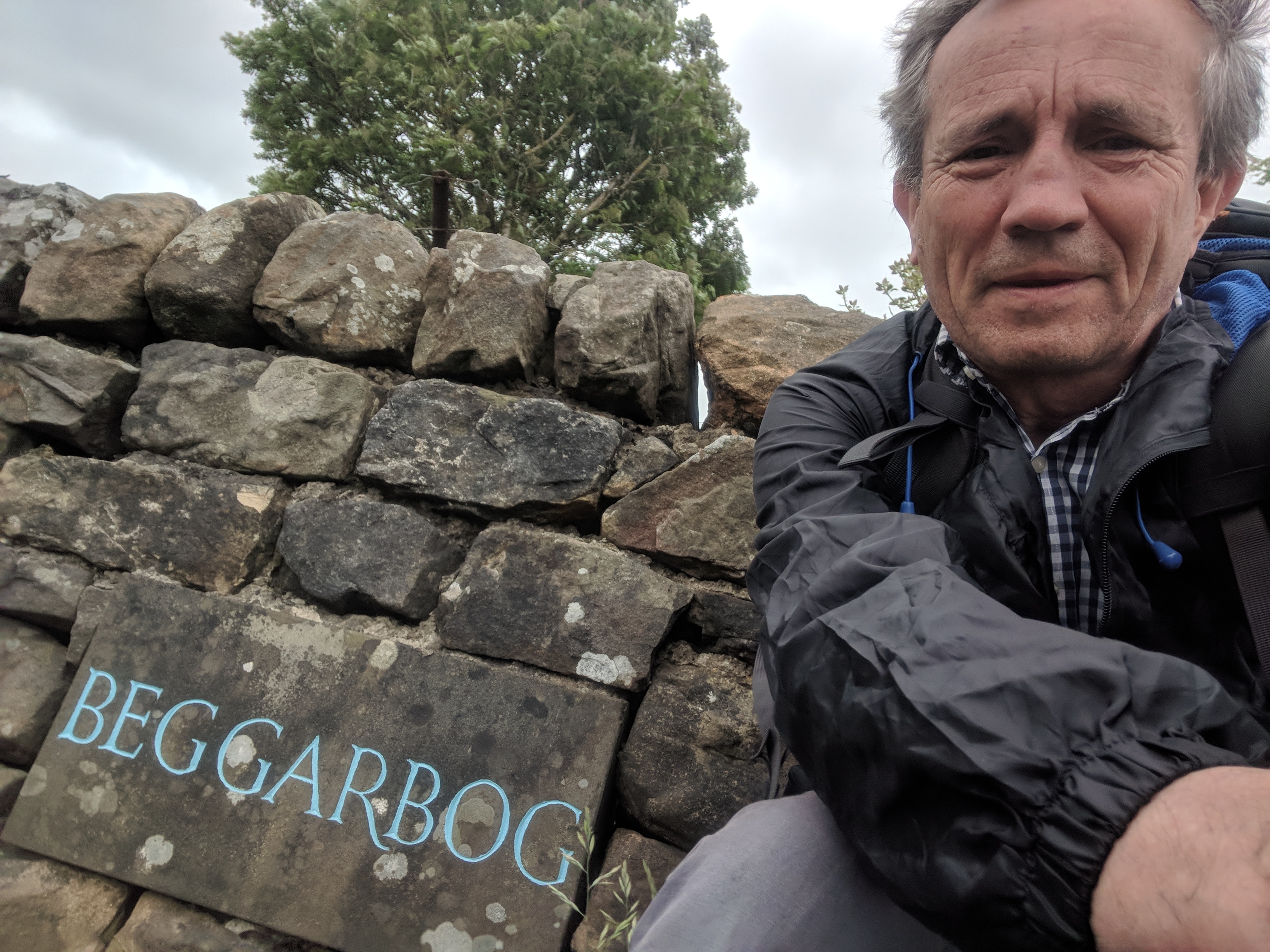
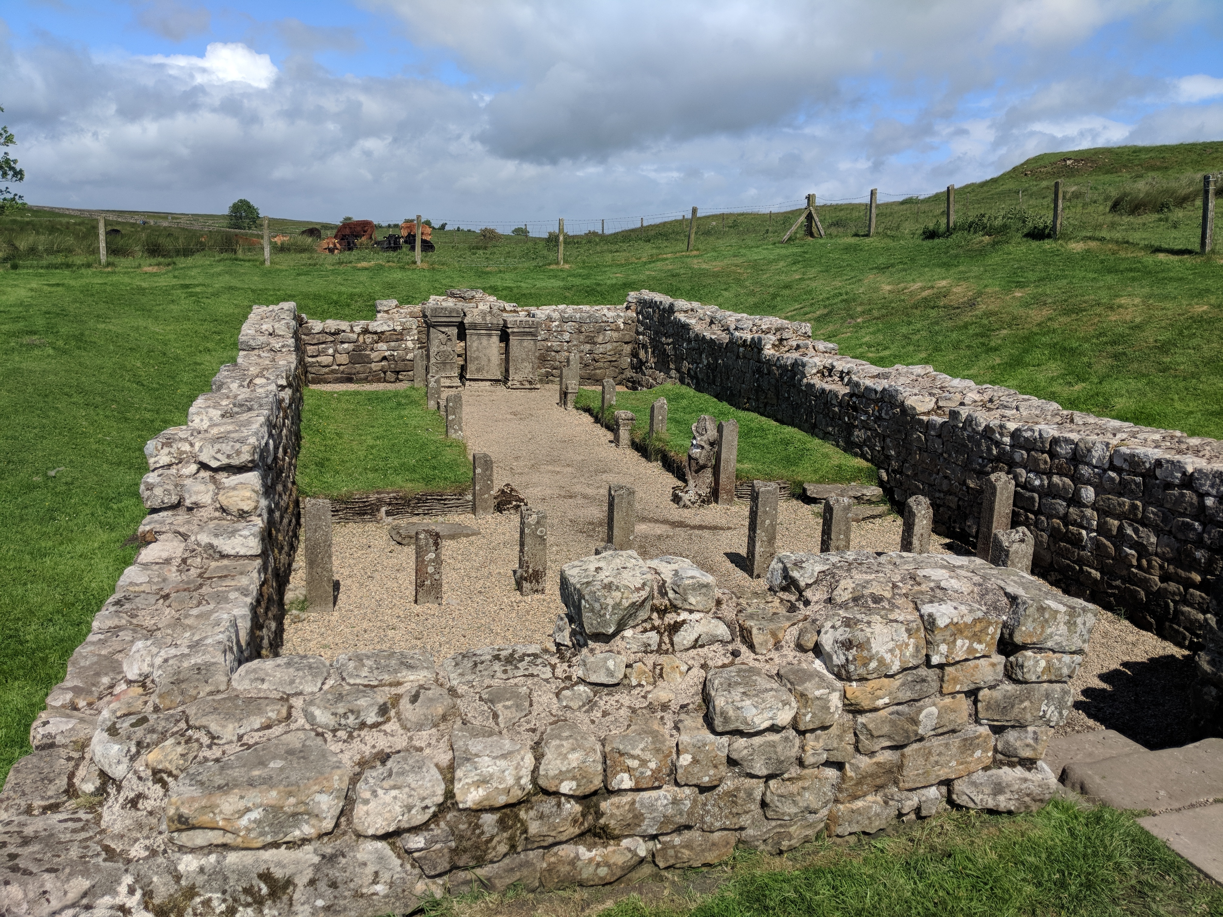
And so down to the sprawling Roman remains of Housesteads, and a very short road walk to my fine B&B at Beggarbog. It’s just a pity the WiFi isn’t a bit better so I could upload pictures.
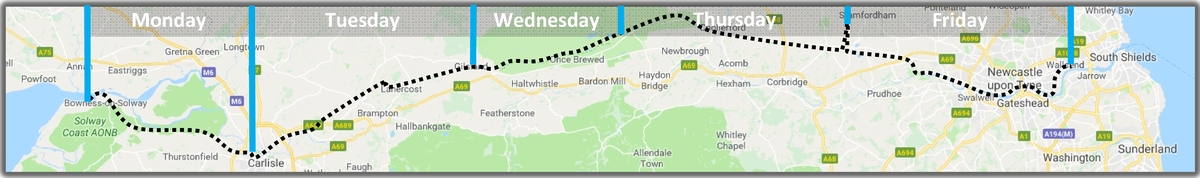
Now for some scheming of tomorrow’s epic 21-mile slog to Stamfordham. It looks like I didn’t quite plan that one correctly. Most of it is fairly flat, but not all; and the weather promises to be interesting.